Bohol tourism centres on an island province in the Central Visayas, known for the Chocolate Hills, Panglao’s dive sites, heritage churches and Philippine tarsiers. This guide maps the main attractions and shows which topic pages go deeper.
It is an independent travel guide, not run by the Bohol Provincial Government, the Department of Tourism, or any tour operator, resort or sanctuary. It takes no bookings and sells no tours, and fees, schedules and opening hours are left to the operators and agencies that set them.
Bohol at a Glance
Bohol is a province situated in the Central Visayas region and occupying the central section of the Visayas, with Tagbilaran as its capital. Its land area is 4,772.52 square kilometers, and the 2020 Census counted 1,394,329 residents. That makes it a mid-sized island province: large enough that the main sights sit in different towns, yet compact enough that most visitors link several of them on one trip.
| Topic | Detail |
|---|---|
| Capital | Tagbilaran |
| Land area | 4,772.52 square kilometers |
| Population (2020 Census) | 1,394,329 |
| Local governments | 47 municipalities and 1 city |
| UNESCO Global Geopark designation | 2023 |
| Geopark area, land and marine | 8,808 km² |
Figures come from the PhilAtlas provincial profile and the UNESCO page for Bohol Island UNESCO Global Geopark.
The geography behind the sights is part of the appeal. According to UNESCO, Bohol Island is the Philippines’ first UNESCO Global Geopark, and its geological identity has been pieced together over 150 million years as periods of tectonic turbulence raised the island from the ocean depths. The limestone forms karst structures, including caves, sinkholes and the cone-shaped Chocolate Hills in the centre of the geopark. Offshore, the Danajon Double Barrier Reef along the northern coast is one of just six documented double barrier reefs on Earth and offers 6,000 years of coral growth to study. For travellers, the practical meaning is variety: a single island holds hills, forest, caves, rivers, reefs and white-sand beaches.
The same geology shapes daily life. UNESCO notes that the island’s main source of income is agriculture, with rice, coconut and corn crops, that fishery and aquaculture are also important for local livelihoods, and that tourism is growing in the area. A visit is therefore a visit to working farming and fishing communities as well as to attractions, which is a good reason to travel respectfully, buy locally where possible and keep to marked trails and sites.
Natural Attractions: Hills, Reefs, Rivers and Forest
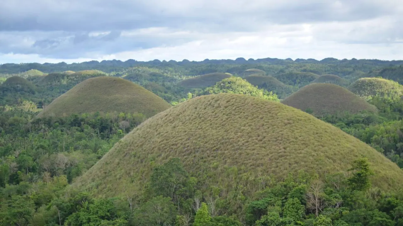
The Chocolate Hills are the image most people associate with the province. The formation is estimated at 1,268 to 1,776 individual mounds, grass-covered limestone domes that turn a chocolate-brown during the dry season. UNESCO describes the smooth, conical hills as the result of thousands of years of erosion of limestone built up from coral reefs that thrived in the Pliocene, approximately 2-5 million years ago. The hills were declared a National Geological Monument in 1988, and a 1997 proclamation set them and the surrounding areas aside as a natural monument covered by the national protected-areas system, with the environment department as lead agency. A viewing deck in Carmen is among the places from which they can be seen.
Because the colour depends on the season, the timing of a visit changes what the hills look like. The seasonal pattern is explained later in this guide, and the full list of excursions is gathered in the hub for the things to do in Bohol, which groups hills, rivers, reefs and caves.
South of the hills, Rajah Sikatuna Protected Landscape is described as the largest remaining tract of natural forest in Bohol and one of the Philippines’ top birdwatching sites. The reference page adds that the park was reestablished in 2000 as a protected landscape under the National Integrated Protected Areas System, covering its present area of 10,452.6 hectares, and that it sits just south of the Chocolate Hills. It is a reminder that the island’s interior is more than farmland and viewpoints. For travellers who want their trip to support conservation and local communities, the guide to bohol ecotourism covers protected areas, community tours and low-impact habits.
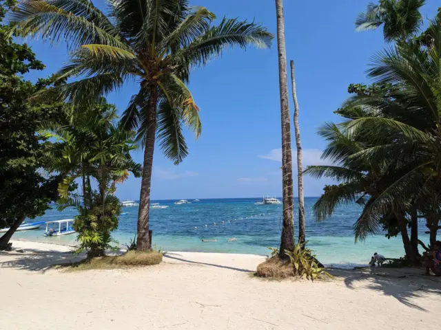
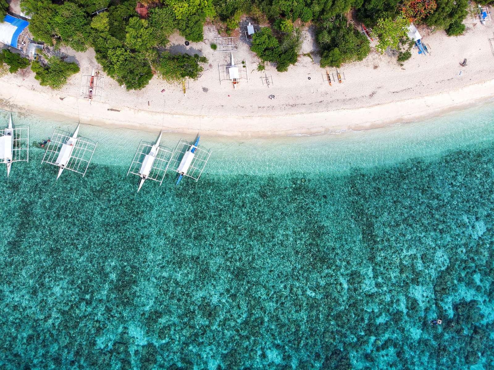
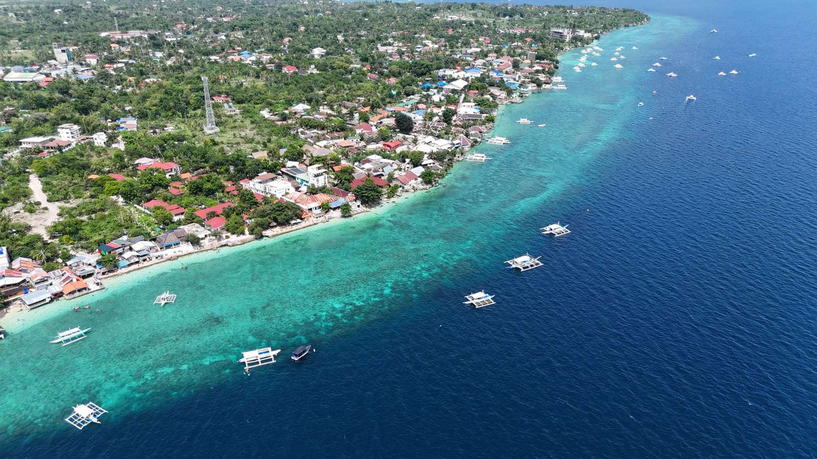
On the coast, Panglao Island is the main base for sea-based activities. A general reference on the province says Panglao Island, located just southwest of Tagbilaran, is famous for its diving locations, with resorts and dive centres along the southern beaches. Alona Beach is a popular scuba-diving and snorkeling spot near a coral reef, and the sand itself is described as spanning less than one kilometre of white powder sand surrounded by low rocky cliffs, so it is a compact beach rather than a long strip. Hinagdanan Cave in Dauis is a naturally lighted cavern with a deep lagoon, lit by sunlight that filters through holes in the ceiling. The same reference notes that the cave is slippery, so footwear and care on the steps matter. Anyone planning to snorkel or dive should follow the rules of the marine sanctuary, avoid touching coral or marine life and choose operators who put reef protection first.
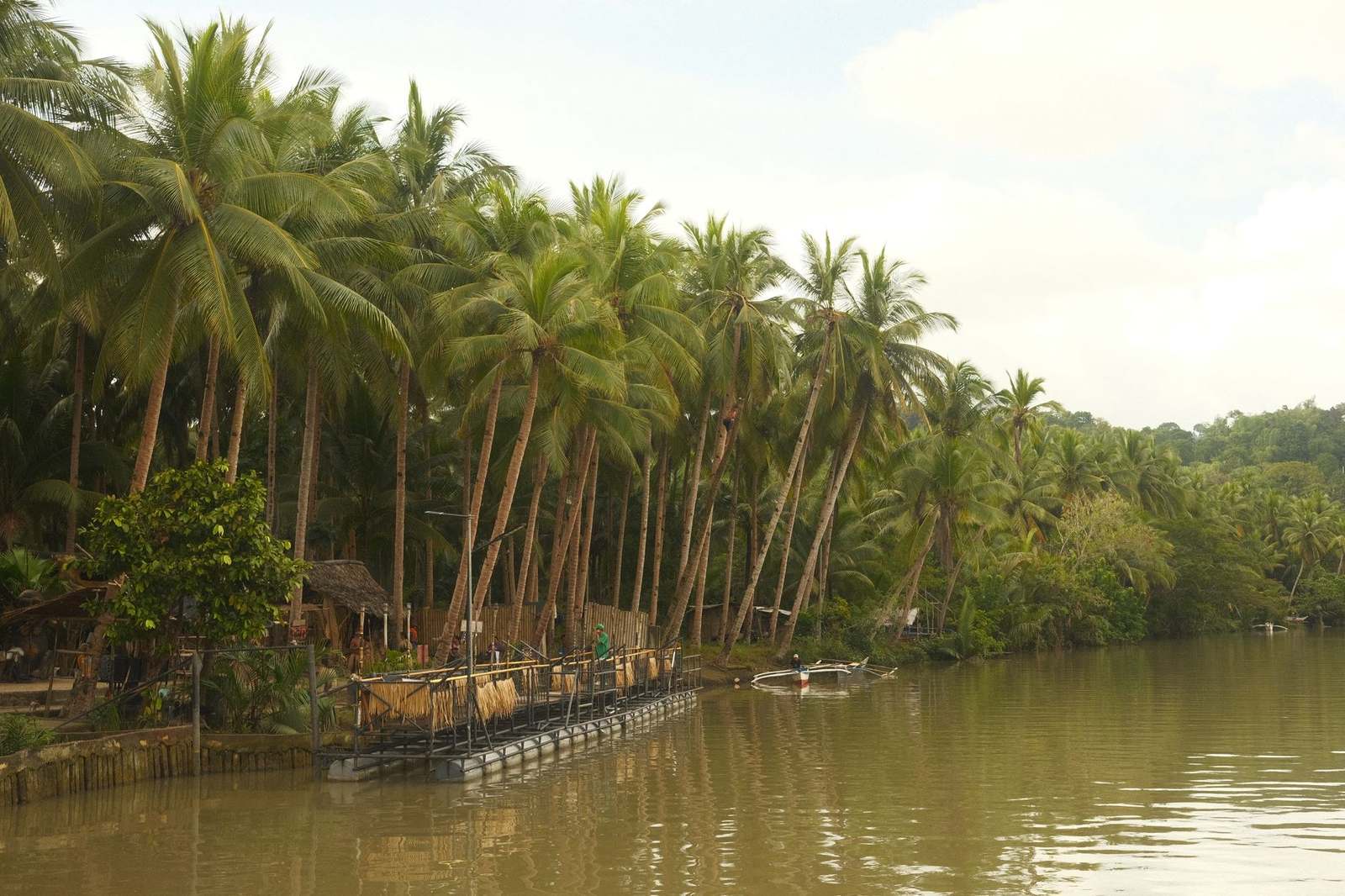
Inland, the Loboc River offers a gentler outing. The Loboc river passes through the town center of the Municipality of Loboc, and river cruises with floating restaurants are among the activities on the water. It is a relaxed counterpoint to the more physical dive and trail options elsewhere on the island.
Wildlife is the other drawcard, and it is the area where visitor behaviour matters most. The Philippine tarsier is described as indigenous to Bohol and among the world’s smallest primates, and its conservation status is Near Threatened on the IUCN Red List. The Philippine Tarsier Foundation was established in Corella, Bohol in 1996, and the foundation runs a sanctuary there with a visitor centre and habitat preserve. Tarsiers are shy animals that hunt at night, and published welfare guidance warns that camera flashes, being touched and being kept in an enclosure stress them. Keep quiet, never touch them and turn the flash off.
The same rule applies to any wildlife activity, whether tarsier viewing or watching dolphins and whales from a boat: keep a respectful distance from animals, never feed or handle them, and follow the instructions of licensed guides and local rules.
History, Churches and Festivals
Bohol’s history is closely tied to a single gesture. A blood compact between the Spanish explorer Miguel López de Legazpi and Datu Sikatuna, chieftain of Bohol, took place in 1565 and is considered the first treaty of friendship between Spaniards and Filipinos. Sandugo is a Visayan word meaning “one blood”, and the image appears on the provincial flag and seal. Readers who want the story and the way it is remembered can turn to the guide to the blood compact shrine.
The Spanish period left a line of stone churches along the coast. Baclayon was founded by the Jesuit priest Juan de Torres and Gabriel Sánchez in 1596 and became the oldest Christian settlement in Bohol, and the present coral stone church was completed in 1727. The National Museum of the Philippines declared it a National Cultural Treasure in 2010. The history of Baclayon Church, including its restoration, is covered in its own article.
Visitors should know that many of these buildings were damaged in recent memory. On October 15, 2013, Bohol was devastated by a 7.2 magnitude earthquake that claimed 222 lives altogether and destroyed or damaged a number of the province’s heritage churches. Baclayon Church was reconstructed by the National Historical Commission of the Philippines from 2014 to 2018, and restoration work at other sites has continued since. Treat church interiors as active places of worship: dress modestly, keep voices low and check whether services are under way before entering.
Celebration is the other half of Bohol’s cultural calendar. The Sandugo Festival is held every July, commemorating the friendship pact and anchoring a month of pageants, parades and street dancing in Tagbilaran. Individual towns keep their own patron-saint fiestas on different dates through the year. The calendar and customs are explained in the guide to Bohol festivals, which is worth reading before fixing travel dates, since a fiesta can change both the mood of a town and how crowded it is.
Tagbilaran, Towns and Local Food
Most journeys pass through the capital at some point. Tagbilaran is the principal gateway to Bohol, 72 km south of the regional capital, Cebu City, and the 2024 census counted 106,120 people there, making it the most populous city in the province. The city is linked by sea to major port cities in the Visayas and Mindanao, so it works well as a first or last stop even for travellers who spend most of their time elsewhere. A closer look at the capital is in the article on Tagbilaran City.
Food is part of getting to know the province. Kalamay, also spelled calamay, is described as a well-known sweet dish from Bohol Province, particularly in the town of Jagna. Sweets like this are the kind of local product travellers often take home, and the island has other dishes as well. The guide to bohol delicacies explains what to try and how local foods fit into a day of sightseeing, which helps in choosing where a detour is worth making.
The wider point is that the best days in Bohol tend to combine a headline sight with a smaller town. A morning at a viewpoint or church followed by an afternoon in a municipal centre gives context that a checklist of attractions does not. With so many local governments to choose from, picking a few and moving at an easy pace usually beats trying to cover them all.
Three Ways to Shape a Bohol Itinerary
Because the sights are spread across several towns, it helps to think in themes rather than a single route. Each theme below groups places that sit near one another on the map, which keeps road time down and leaves room for unplanned stops.
The first theme is the interior nature day. The Chocolate Hills, the viewing deck in Carmen, the Loboc River and Rajah Sikatuna Protected Landscape all sit in the middle of the island, and the landscape reference notes that the protected area lies just south of the hills. This day suits travellers who like open views, forest air and riverside meals, and it works best when the weather is clear. In the dry season the hills show their chocolate-brown colour, while in other months they stay green, so the same stop looks different depending on when it is made.
The second theme is the heritage day along the coast. Baclayon Church, the blood compact story and Tagbilaran’s city centre form a natural loop close to the capital, and the Sandugo Festival in July adds a calendar reason to schedule it then. Heritage sites reward unhurried visits, since much of their interest lies in small details of stone, carving and local explanation rather than in headline views.
The third theme is the Panglao sea day. Diving, snorkelling and beach time cluster around the island’s southern beaches, near the airport that serves the province. This is the easiest theme to combine with a flight, because the airport and the main beaches are on the same island. It is also the theme most dependent on sea conditions, so a flexible day or two in the plan is sensible.
A trip need not use all three. A short stay might pick one theme and add the capital; a longer visit can alternate nature, heritage and sea days so that tiring road journeys are spread out. Whichever mix is chosen, the Things to Do hub mentioned earlier covers the individual sights in more depth, and the topic pages linked throughout this guide describe each place on its own terms.
Planning Your Bohol Trip
Planning for Bohol starts with the way in. Domestic and international travellers arrive by air or by sea, and the guide on how to get to Bohol sets out the options for each route. The island’s main airport is on Panglao. According to its reference page, the airport opened on November 28, 2018, replacing Tagbilaran Airport, and it is less than an hour’s flight from Mactan–Cebu International Airport. The design and facilities are discussed in the article on Bohol Panglao International Airport.
Timing matters as much as routes. The national weather agency PAGASA divides the year into the rainy season, from June to November, and the dry season, from December to May, and splits the dry season into a cool part from December to February and a hot part from March to May. Typhoons influence much of the country’s weather, so travellers should check current PAGASA advisories close to departure. The detailed month-by-month view is in the guide to the best time to visit Bohol.
Where to base yourself shapes the whole trip. Panglao suits beach and dive plans, Tagbilaran suits short stays and transfers, and the countryside suits hills, forest and river sights. The comparison is laid out in the article on where to stay in Bohol, which does not rank individual resorts. Since many sights are spread across the island, choosing one base and making day trips usually costs less time than moving hotels repeatedly.
Beyond the island itself, general preparation for the country matters: entry requirements, money, connectivity, health and etiquette all sit outside Bohol-specific advice. Those basics are gathered in the hub of Philippines travel tips. For official entry rules, travellers should rely on the Philippine government and their own embassy rather than third-party summaries.
A simple order of work helps: fix the dates against the weather and any festivals, choose a base, book transport and rooms directly with the operators involved, then shortlist a handful of sights. Fees and schedules for sanctuaries, caves, viewing decks and boat trips are set by their operators and local governments and change over time, so confirm them with the operator shortly before going.
Visiting Responsibly
Bohol’s appeal depends on fragile things: reefs, forest, cave formations, old church fabric and animals that react badly to crowds. A few habits protect them. Stay on marked paths and viewing decks, carry rubbish out, avoid standing on or touching coral, and choose guides and operators who explain their own rules before the activity starts.
Wildlife deserves particular care. Tarsiers, dolphins and whales are wild animals, and enjoying them means observing from a distance set by the guide or sanctuary, using no flash, never feeding or handling them and leaving immediately if an animal appears distressed. If an attraction invites visitors to hold or pose with an animal, that is a reason to walk away.
Safety and entry information is best taken from official sources. For weather and typhoon information the source is PAGASA, for travel notices the Department of Tourism, and for citizens abroad their own embassy. This guide does not replace them, and it offers no medical or legal advice. Because rules, fees and schedules shift, confirming details with the managing office shortly before a visit avoids wasted trips.
Respect for local communities matters as much as respect for nature. Ask before photographing people, support local businesses when buying food and crafts, and treat festival processions and church services as community occasions rather than performances.
Frequently asked questions
Is this the official Bohol tourism website?
No. This is an independent travel guide and has no connection to the provincial government, the Department of Tourism or any operator. It does not sell tours or take bookings.
What is Bohol best known for?
The Chocolate Hills, the Philippine tarsier, dive sites around Panglao Island, centuries-old stone churches and river cruises on the Loboc River are the sights most often associated with the island. UNESCO also recognised the whole island as a Global Geopark in 2023.
When is the dry season in Bohol?
PAGASA describes the Philippine dry season as running from December to May, with a cooler period from December to February and a hotter one from March to May.
How should visitors behave around tarsiers?
Stay quiet, do not touch the animals, and never use flash. Camera flashes and handling are listed among the activities that stress these shy primates, so responsible sanctuaries restrict them.
Do the Chocolate Hills really change colour?
The hills are covered in green grass that turns chocolate-brown in the dry season, which is where the name comes from. In wetter months they appear green.