A Bohol mangrove tour usually means walking or paddling through a coastal forest that a local community protects, and the best-documented example is the Savima community tour in San Vicente, Maribojoc.
The most recent published account of that tour running that was found for this guide is Rappler’s report of 23 October 2014, and whether it still operates could not be confirmed from an official source. Visitors should check with the Maribojoc municipal tourism office or the Bohol Provincial Tourism Office before travelling.
This guide is independent and is not run by, or affiliated with, any tour operator, community group or government office. It sits alongside the wider things to do in Bohol overview and explains what a mangrove outing involves, how the Savima community built its tour as it was reported in 2014, and what to confirm locally before going.
What a mangrove tour actually shows
Mangroves are a group of trees and shrubs that live in the coastal intertidal zone, according to the US National Oceanic and Atmospheric Administration. They grow in low-oxygen soil where slow-moving water lets fine sediment build up, and they only grow in tropical and subtropical latitudes because they cannot withstand freezing temperatures.
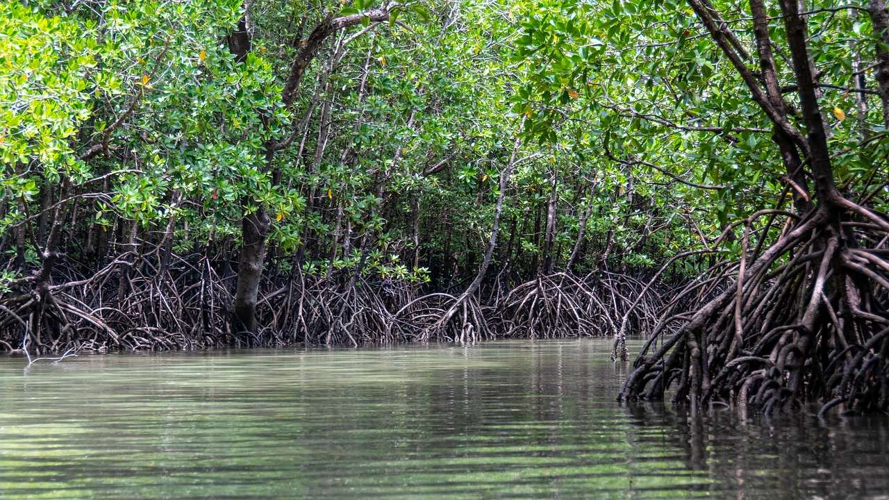
The feature most visitors notice first is the root system. Many mangrove forests can be recognised by a dense tangle of prop roots that make the trees appear to stand on stilts above the water, as the same NOAA page explains. Because most mangroves are flooded at least twice a day, the scene changes with the tide, so a walk or paddle at a different time of day can look like a different place.
Those roots do real work. The tangle slows the movement of tidal water, so sediment settles and builds up the muddy bottom, and mangrove forests stabilise the coastline by reducing erosion from storm surges, currents, waves and tides. The same root maze is attractive to fish and other organisms looking for food and shelter from predators. For a visitor, that translates into things to look for rather than things to expect, such as small fish in the shallows and shells in the mud. What actually turns up depends on the season, the tide and the hour.
Mangroves also matter beyond the shoreline. NOAA’s blue carbon explainer notes that mangroves, sea grasses and salt marshes “capture and hold” carbon, acting as a carbon sink. A guided mangrove outing is therefore a chance to see a habitat that shelters juvenile marine life, protects a shoreline and stores carbon at the same time.
Savima in San Vicente, Maribojoc
Savima is the shortened name of the San Vicente Mangrove Association, the community organisation that was behind the tour in the sources cited here. The forest lies in the coastal municipality of Maribojoc. According to PhilAtlas, Maribojoc has a land area of 49.35 square kilometres, was home to 22,178 people at the 2020 census. The town has 22 barangays, and San Vicente is one of them.
The forest itself was described in Rappler’s report of 23 October 2014 on the community. In that article, the 56-hectare mangrove forest was said to have given income to residents since they transformed it into an eco-tourism spot, and the forest was reported to hold 25 different species of mangroves. The same report called it one of only two major tourist destinations in the town, the other being the Maribojoc church. As of that report, residents served as tour guides in the mangrove forest.
How the community built the tour
The tour grew out of a conservation problem rather than a tourism plan. Rappler reports that, according to SaViMA president Septima Puyo, the community took steps to protect the forest when residents noticed that fish and shrimp supplies were being depleted by indiscriminate cutting of the mangroves. The association was established in 1996, and Rappler described SaViMA in 2014 as operating under a 25-year community-based forest management agreement with the Department of Environment and Natural Resources.
The outcome that residents describe is practical. In the Rappler report, Puyo says, “We realized that the mangroves can be our source of livelihood in many ways. We had to stop cutting them.” The supply of shrimps, fishes and other shellfish also increased, giving residents food to eat and to sell in the local market.
An older account gives a sense of what the day-long programme looked like. A Philippine Information Agency release, reposted on a Bohol community forum and dated June 2007, describes a one-day eco-tourism mangrove adventure package that included a river cruise from the Abatan River to the Tintinan mangrove plantation, a guide from the SAVIMA community and the planting of mangrove propagules and seedlings. That description is a record of one group’s visit in 2007, not a current itinerary.
As of the October 2014 Rappler report, visitors could also join mangrove planting, home stay programmes, shell gathering and shrimp planting for a fee, aside from simply spending time at the beach. Residents interviewed in the same piece say the income from visitors is shared among members and described it as relatively small but a real help with daily needs. The report says residents take shifts making rounds to protect the forest, and names illegal loggers and fishermen using prohibited methods as the biggest threats.
The earthquake and the rebuilt boardwalk
The October 2013 Bohol earthquake hit this community directly. Rappler reports that the 7.2-magnitude quake damaged both SaViMA and the Maribojoc church, that some mangroves were ruined and had to be replanted in places, and that the 500-meter boardwalk cutting through the forest to the islet of Tintinan collapsed. Residents rebuilt using construction materials from the Department of Social Welfare and Development and the National Housing Authority.
According to the same report, SaViMA reopened for tourists in March 2014, after a few months of closure. Local guide Juanita Kristal, quoted by Rappler, said visits for home stays during summer and long holidays had been in steady decline since the earthquake. The point for a present-day visitor is that the walkway, the guide arrangements and the programme on offer have all been rebuilt at least once, so older descriptions of lengths, fees and routes should not be treated as current.
Other mangrove tours on Bohol’s tourism map
Savima is not the only community mangrove outing on the island. The Bohol Provincial Planning and Development Office publishes a tourism map of attractions and packaged destinations that credits the Bohol Tourism Office as its source and is dated 2016, as published online. Several mangrove-related entries appear on it.
| Listing | Location |
|---|---|
| Savima Community Life Tour | San Vicente, Maribojoc |
| Banacon Mangrove and Seascape Tour | Getafe |
| Candijay Mangrove Adventure Tour | Panadtaran, Candijay |
| Bohol Paddling Adventures | Kawasan, Cortes and Puntod Island, Panglao |
Listings reproduced from the Bohol tourism map on the Bohol Provincial Planning and Development Office website, whose source line reads “Bohol Tourism Office, 2016”. Operators, routes and availability can change after a map is published, so a listing shows that an offering existed rather than that it is running today.
Why Philippine mangroves are worth protecting
The Savima story reflects a national pattern. GMA News Online reported in February 2023 that, according to a broadcast report, mangrove areas “went down from 500,000 in 1918 to 240,824 hectares in 2010”. The reasons it lists include reclamation projects and the creation of fisheries.
The same report quotes Severino Salmo III of the UP Diliman Institute of Biology, who said, “We need to complement conservation, limit the mangrove losses that is the conservation side.” He added that the country needs a strategic restoration programme. Community-managed forests such as the one in San Vicente, where, as reported above, residents patrolled, replanted and limited cutting, are one form that restoration and protection can take.
For travellers who like to match their itinerary to their interests, a mangrove outing pairs naturally with other nature stops on the island. The Hinagdanan Cave in Panglao covers underground scenery, and the Bohol Biodiversity Complex in Bilar covers a different part of the island’s wildlife and plant life.
Visiting responsibly and what to confirm locally
Fees, hours, tour formats and meal arrangements for the Savima tour are not published here, because published figures have varied between sources and years. Anything quoted from an older article is a snapshot of that date only. The newest published account of the Savima tour running that was found for this guide dates from October 2014, and current operation could not be confirmed from an official source. Before going, confirm the following directly with the Maribojoc municipal tourism office, the Bohol Provincial Tourism Office or the community association:
- Whether the Savima tour is still operating at all and, if it is, whether the boardwalk and the river or boat route are open on the day, and how tide and weather affect them.
- Which activities are on offer now, such as guided walks, planting, home stays or meals, and how arrangements are made.
- What is charged, how it is paid and who the money goes to.
- Where visitors are allowed to walk, and which areas are restricted.
On the ground, the etiquette follows from what the forest is. If a tour is running, stay on the boardwalk or the route your guide sets, because roots and young seedlings are easily damaged. Do not pull propagules or break roots for souvenirs, take every piece of litter out with you, and treat shells, crabs and fish as part of the food supply of the households that live here.
Bohol’s weather and sea conditions vary through the year, so check forecasts from the national weather agency before travelling. Government sources such as PAGASA are the right place for storm and tide information; this guide does not offer safety advice of its own.
Frequently asked questions
What is the Savima mangrove tour, and does it still run?
According to Rappler’s report of 23 October 2014, it was a community-run mangrove tour in San Vicente, Maribojoc, organised by the San Vicente Mangrove Association, with residents serving as guides in a 56-hectare forest that had become an eco-tourism spot. Whether it still operates could not be confirmed from an official source, so check with the Maribojoc municipal tourism office or the Bohol Provincial Tourism Office before travelling.
Is this site the tour operator?
No. This is an independent travel guide. It does not take bookings, sell tours or set prices, and it has no connection with the association, its guides or any government office.
How much does a mangrove tour in Bohol cost?
No current figure is given here because fees change and published numbers differ. The 2014 Rappler report says only that some activities, such as planting and home stays, were offered for a fee. Ask the association or the Bohol Provincial Tourism Office for present rates.
Can the mangrove forest be visited at any time of day?
Tides change the look of a mangrove forest, since most mangroves are flooded at least twice a day according to NOAA. Whether tours run at particular times, or are limited by tide or weather, should be confirmed with the community before travelling.